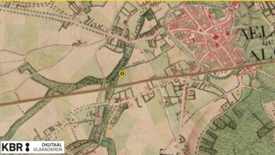
Take a look at your piece of land from the air. That is what you can do via Geopunt Vlaanderen.
Download our course ‘Step 1: The soil’ and it explains how you can get started with this.
But definitely recommended to look at maps from the past. To investigate which soil type occurs in your region and to see the boundaries of your terrain.
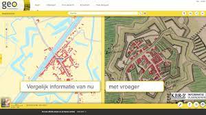
Please note only a sworn surveyor can officially determine your borders. So never base yourself on a plan or map. But definitely fun to do.